Updated: 2/20/2026
Important: your memberships in both USHPA and NEPHC must be current to fly at Cannon Mt.
Tram operators will require proof of both current NEPHC membership and USHPA membership. If you only have USHPA membership, you are not allowed to fly. Cannon will not be responsible for contacting NEPHC to verify membership.
If you intend to fly, go to this page: Membership status, create a screenshot on your phone to provide to the Cannon Tram operator along with your driver’s license (or government-issued ID). There may not be cell signal at the mountain, so be sure to create the screenshot prior to arrival. The tram operation has a current list of members from NEPHC for verification.
The permit for flying is only valid in the season when Tram is in operation. No flying is allowed from the last skiing day, to May 27.
No flights are allowed prior to daily tram operation; you need to wait for Cannon employees to be present in order to sign in at the base lodge (see below – Rules and Regulations).
-
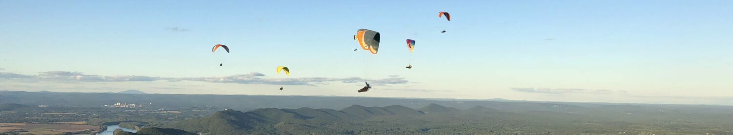
- Flight Type: Ridge and Thermals, potential XC site
- Required: valid current USHPA and NEPHC memberships. Tram operators will require proof of both NEPHC membership and USHPA membership. If you only have USHPA membership, you are not allowed to fly. Cannon will not be responsible for contacting NEPHC to verify membership.
- USHPA Rating Requirement: P3
Flying at Cannon Mountain is currently limited to mountain qualified
P3 pilots due to the required knowledge to flying in Alpine conditions
in the Northeast USA. Specifically, the requirement to research the
proper meteorological conditions for safe flight at this site. As the
launch is over 4000ft. MSL, the conditions can rapidly change in the
area for safe flight. Valley winds can also build during the day. - For the 2025 season, only Paragliders and Mini Wings will be allowed.
- No top-landings
- Flying only permitted off ski season, when snow is gone and skiing has stopped (after May 27th typically).
- Wind direction: N – NE (Ideal: 340 – 010 degrees, OK: 330 – 20)
- Wind speed (PG):
- 0 mph minimum
- 10 mph ideal
- 15 mph maximum – do not launch a standard sized paraglider in wind exceeding 15 mph unless you are certain you have the skills and your glider can penetrate. Mini wing operating limitations at the pilot’s discretion.
- +5 mph maximum gusting
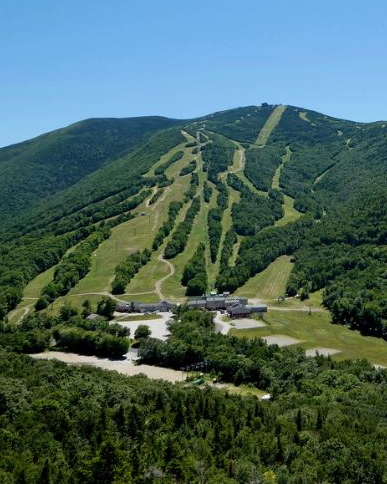
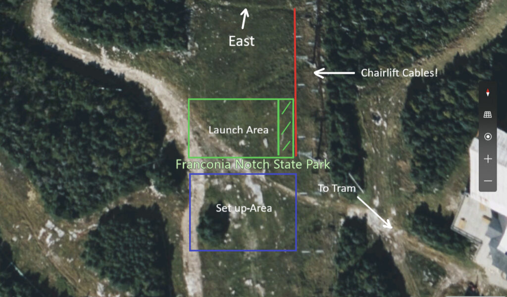
- Launch: The Cannon Mountain ski run named Profile, East facing, 4080 ft. summit (1244m) approximately 100ft. wide as shown below. Be careful of crosswind turbulence on the launch due the proximity of the trees on either side.
-
- Airspace: There is an airport approximately 2.5 miles away so there are occasional low flying aircraft in the area.
- Hazards: Chairlift Cables directly to the right of launch shown as a red line on the image above. Keep adequate distance to the cables during launch as suggested by the green shaded area on the image.
- Air traffic: The launch site is right under Yankee MOA (Military Operating Area) 1 and 2. Which means possible military flights through the airspace. Nearby Franconia Airport (1B5) hosts a large number of sailplanes and gliders in the Summer.
- Pay attention to tow planes with Glider tow lines behind descending and normal general aviation airport operations as well. If you are landing at Franconia Airport, best practice is to use a small right-hand landing pattern. Watch for GA and glider traffic. Do not descend to land in the approach to the runway. Try and land to one side of the active runway.
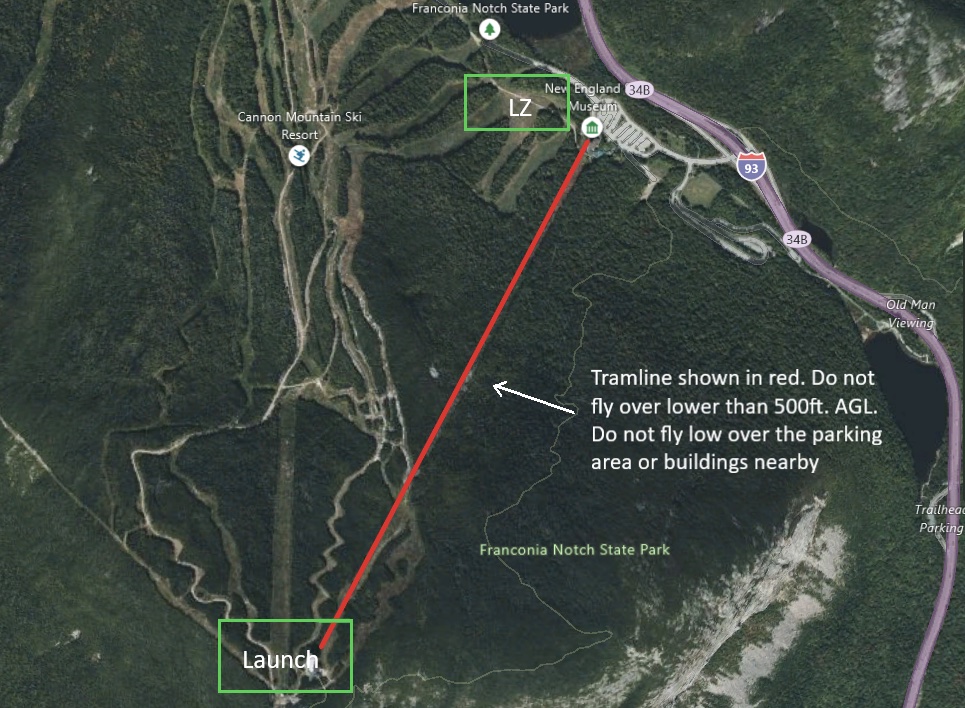
- Tramline to the East: Stay away from the Tram line! Fly at least 500 vertical feet above and 1000 horizontal feet in all directions from the tram and cables running up the eastern side of the mountain (see the Bold Red Line in the General Site Layout image below).
 Landing Zones
 Landing Zones
There are two approved landing zones. The Main LZ and the alternate at Franconia Airport.
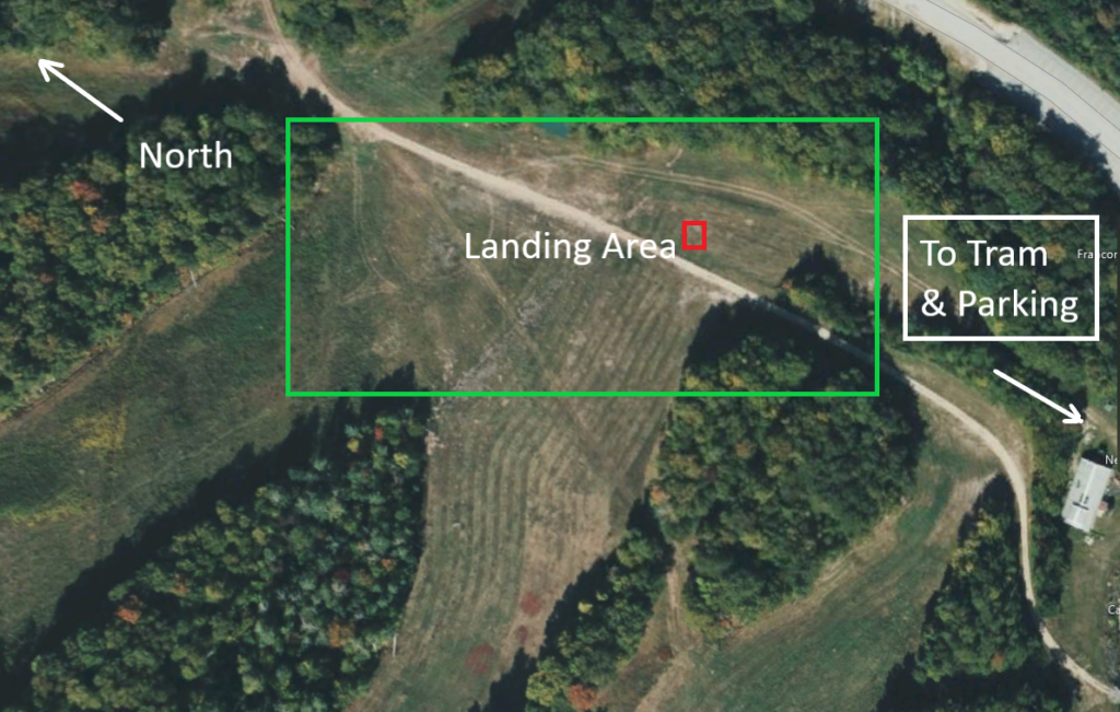
Main LZ
The main LZ is shown as a green box below. The minimum required glide ratio to the main LZ is 2.6:1. GPS coordinates are: 44.171286, -71.691545.
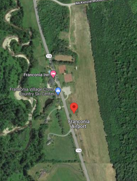
Franconia Airport
Franconia Airport 1B5 is on Route 116. Unicom frequency is 122.8. GPS coordinates: 44.194641, -71.751672.
Rules and Regulations
-
-
- You must be a current USHPA and current NEPHC member.
- Screenshot this page – Membership status – and provide your driver’s license (or government-issued ID) required to show to Tram operator.
- Land only at the designated PG approved LZ or and the Franconia airport.
- Register in the NEPHC Book in the base lodge. All pilots must sign in, even if you have registered in the past.
- For the 2025 season, only paragliders and mini wings will be allowed.
- If you want to ride up the mountain, online Tram ticket reservations are required.
- Space is limited. If the Tram sells out, walk-ons will not be sold a ticket.
- You must either buy a Round Trip Tram Ticket or hike up. One way tickets will not be sold. Online reservations for tickets are required – go to https://www.cannonmt.com.
- Hiking up is only permitted on hiking trails (Kinsman Ridge Trail), NOT on the ski slope.
- Permit is only valid while Tram is in operation. No flying from closing ski day to May 27.
- No flights prior to daily site operation; you need to wait for Cannon employees in order to sign in at the base lodge.
- Tramline: Stay away from the Tram line! Fly at least 500 vertical feet above and 1000 horizontal feet in all directions from the tram and cables running up the eastern side of the mountain
- You must be a current USHPA and current NEPHC member.
-
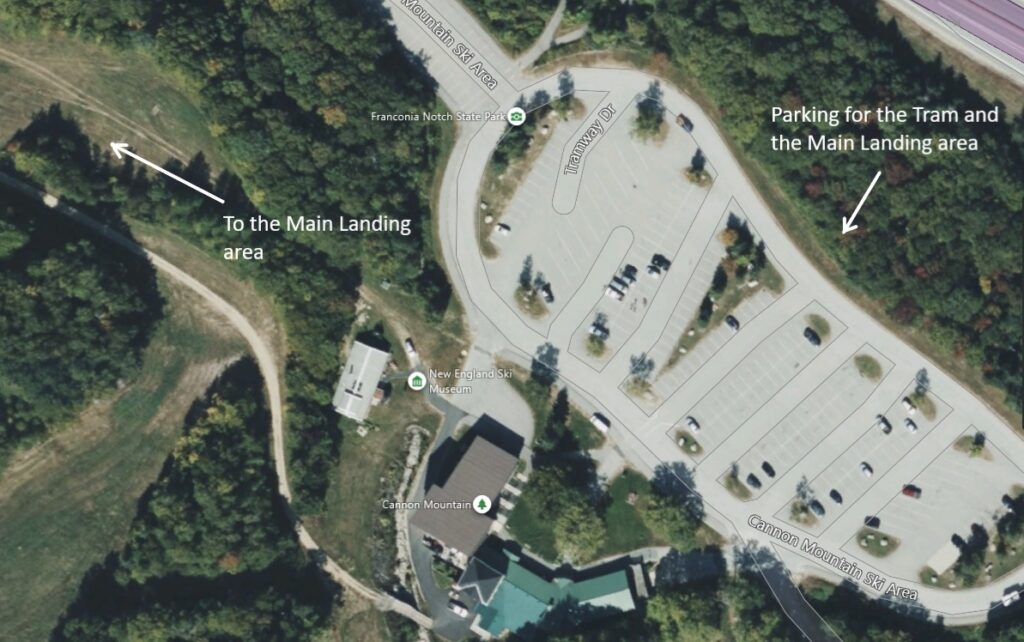
Directions and parking
- 93 North to Cannon Mountain
- Exit 34B – Cannon Mountain Tramway
- Park anywhere in the parking lot.